Search This Blog

Showing posts with label Waze. Show all posts

Tuesday, June 14, 2022

Dim Sum - San José

This past Sunday, June 12th, we drove from our house in San Roque de Grecia to San José to have dim sum at Casa China.

We have previously eaten dim sum at this restaurant and I did a blog post on it here.

This Sunday, we were treated to a stage show of dancers and music. I made a short video:


This venue is typical of the dim sum restaurants we were accustomed to when we lived in Vancouver, British Columbia, and when we would go for dim sum in Richmond, B.C. Large open space with tables big enough for families to sit at. 

As is typical in dim sum restaurants, carts were rolled around with the prepared offerings and we could select what we wanted. Everything was very good.

Since we were going to San Jose, I wanted to combine dim sum with shopping at an Asian grocery store that came highly recommended. That would be Super Asia in the Tibas area of San Jose. They are open on Sundays. Here is what I bought:


Fish sauce, dried mushrooms, mirin, oyster sauce, candies, miso, and a packet of noodle soup.

Also, varieties of frozen dim sum: 


Note: we needed to use the Waze app numerous times to navigate where we wanted to go. It takes two people … the driver to listen to the instructions and the passenger to watch the on line instructions on what road to turn into next. Also BEWARE there are many serious potholes on some of these roads between Casa China and Super Asia.

Click on images to enlarge.
Monday, December 20, 2021

Lunch - Blue’s Cafe Arte and Cafeteria, San Ramon, Costa Rica

Today we drove to San Ramon (about 40 minutes away) to have lunch at Blue’s Cafe Arte and Cafeteria. It has received good reviews and the menu looked interesting.

It took a while to find a parking space but we finally found one a short walk away. Blue’s is inside a small mall and there are tables inside the restaurant and also outside in a covered mall.

Service is fast and the servers very nice. It’s not a large restaurant but it’s upscale. They offer live music and today we enjoyed a guitar player.

For refreshments, I ordered the “ice macchiato de caramelo”. It was really good - I like iced coffee and of course caramelo in or on anything:


Lance opted for the “cappuccino doble espresso” and pronounced it perfect, with the double shot of espresso and a mouse:


I wanted a hamburger today, something I don’t often order. This one - “hamburguesa de la casa” - was excellent. The bun was not too “bready”. It had onions, cheese, lettuce and bacon and came with a side of fries and a dipping sauce.


For Lance, it was the “wrap Cesar de pollo”, accompanied with waffle fries. I really like these and I wonder where I can buy them - maybe in the frozen section in a grocery.


As is usual for us, we couldn’t eat everything on our plates so we came home with half a burger and half a wrap - there’s dinner.

If you are in San Ramon, do try this restaurant. They are doing a great job.

We turned on Waze to make sure we got out of the city in the correct direction to get to our house in Grecia. It took us on an indirect route which we did not expect. The route was not anything like Highway 1, the freeway. Instead, we were met with switchbacks going up and down, no shoulders, and steep dropoffs with no guardrails (because there were no shoulders to support guardrails). It was definitely cocktail hour when we made it home.

Click on images to enlarge.
Monday, February 24, 2020

Circumnavigating the Poás Volcano - Driving in Costa Rica

On a lazy Sunday morning, it was not our intention to drive around the base of the Poás Volcano (Volcán Poás in Spanish). But we ended up doing so. At the beginning of the day, our basic question to each other was "is there anything you want to do today?". We could laze around the house all day or take a drive somewhere - wherever.

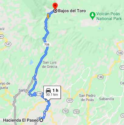
With the help of Google, we discovered a place called Bajos del Toro located roughly northwest of the volcano. The area looked interesting. Google Maps indicated that it was about a 30 kilometer (19 mile), 1 hour drive from where we live (Hacienda El Paseo). The main roads were identified as routes 118 and 708.

The 1 hour drive time for the short distance involved ought to have been a warning. But, the message went right over our heads. At first, the roads were paved and fairly good. However, at one stage, road 708 deteriorated into steep switchbacks followed by rocky, bumpy sections narrowly grooved on the sides of a mountain. We slowly edged along these sections at walking speed and there was no real problem. But, had we encountered another vehicle moving in the opposite direction, then there would have been a problem. Somebody would have had to back up to a place having at least some shoulder room allowing the vehicles to pass. Who has the right of way in such circumstances? On a hill, I expect it would or should be the downhill driver.

The altitude where our doubts began was over 1800 meters (6000 feet) and the temperatures were much lower than further down. However, the road ultimately returned to pavement as we descended into Bajos del Toro.


It may be noteworthy that one commentator on the link provided above to Bajos del Toro described a "road from hell". She did not say that this was road 708, but I have little doubt that she was referring to road 708.

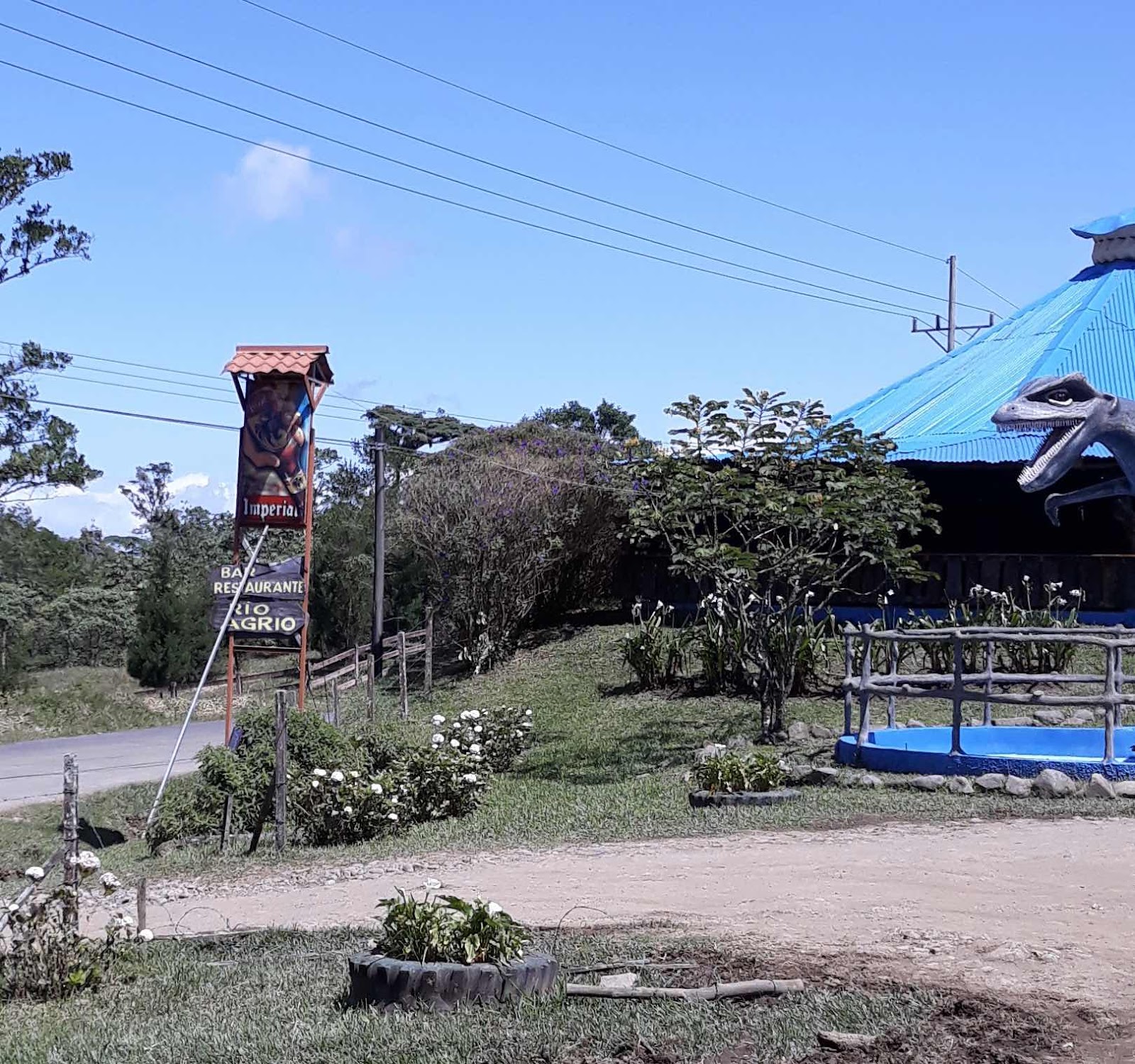
Bajos del Toro is an interesting place located in a river valley with waterfall landmarks and other amenities all around. We elected not to join with the many tourists who had obviously arrived from a different direction. Instead, we decided to take a break at a local restaurant (Catarata Rio Agrio).


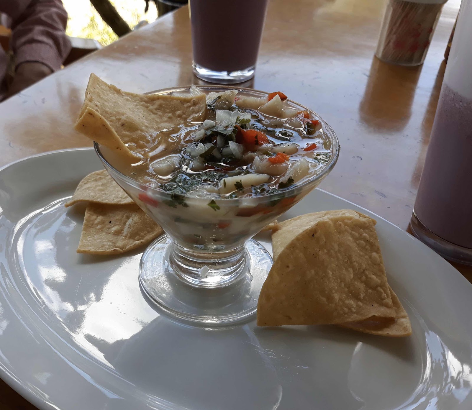
Ceviche - a favourite. Also ordered mora bedidas (blackberry fruit drinks with milk).


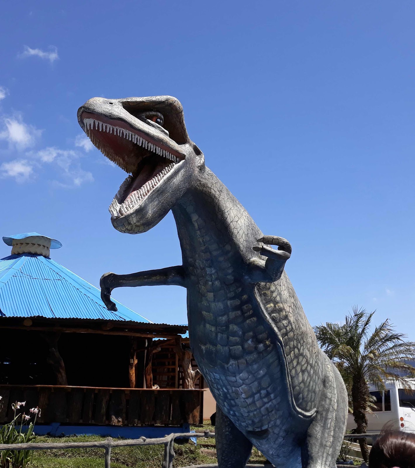
It was so funny to see these dinosaurs up in the mountains.


While at the restaurant, we decided there was no way we would retrace our steps in the direction from whence we had come (from the south). But, we were using Waze (a navigational app that works on my smartphone) and the voice insisted that we go back the way we came. Ignoring those instructions, we headed north on road 708.


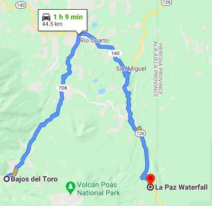
Northward, road 708 was paved and crossed back and forth across a small river several times. But, it was necessary to keep eyes open for the odd rough spots and potholes. We eventually emerged from the valley and were treated to some sweeping flatland vistas to the north and west. Along the way, we tested Waze two or three times for new directions but Waze kept telling us to turn around. Ultimately, road 708 terminated at an intersection with well paved east-west road 140. We decided that west was definitely wrong and turned east. Somewhere along 140, we tested Waze again and got the reply we were waiting for (keep going in the direction you are going, or words to that effect).

Frankly, at this point we had no idea where we were but once again we were trusting Waze. At a small village named San Miguel, we were guided from road 140 to road 126 heading south. Road 126 turned out to have several steep switchbacks but they were not problematic. The road was paved and generally in very good condition.

Eventually came a turn in the road where we were greeted by an impressive waterfall right on the edge of the road in front of us. We stopped along with many others who had parked on the roadside to take pictures.


Moving on a very short distance, we were surprised to happen upon La Paz Waterfall Gardens & Peace Lodge. Now we knew exactly where we were because we had been there before. But, we had seen the falls from a totally different vantage point from inside the Gardens and not from the road (see my blog entry on February 8, 2014).

The last leg:

The first time we were at La Paz, we drove from Atenas where we were living at  the time. If we were driving back to Atenas then we might have managed without Waze. But, we weren't. We were driving back to Hacienda El Paseo. So, we continued to rely on Waze without which numerous wrong turns undoubtedly would have doubled or tripled the drive time from La Paz. The directions from Waze now included roads 126, 120, 146, 118, then local. Road conditions ranged from very good to paved but narrow and marked by patches and some potholes.

When driving in Costa Rica, we have found Waze to be invaluable. But, Waze sometimes gets things wrong. I think Waze kept trying to turn us around on road 708 and part of road 140 by comparing the time in one direction with the time in the opposite direction. Problem is that this approach had no regard for the terrible conditions we encountered on part of road 708. As an aside, we were guided by Waze on one earlier occasion to a road so bad that we were compelled to turn around. A John Deere tractor might have managed, but not our Subaru Forester.